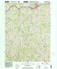
1998 Map of Claysville
USGS Topo · Published 1999About this map
The National Road corridor defines the northern reaches of this Washington County landscape, connecting the borough of Claysville with the smaller settlement of Coon Island. The area is characterized by a dense network of watercourses, including Robinson Fork, Dutch Fork, and Middle Wheeling Creek, which carve through the terrain of Donegal and East Finley townships. These valleys serve as the primary conduits for settlement and early industry, as evidenced by the numerous Gas Wells and occasional Oil Wells scattered across the hillsides.
Find a feature on this map
42 named features on this map. Tap any name to fly to it.
Don’t see what you’re looking for? This feature index may not catch every label — zoom into the map to look around manually.
Map Details
Editions of this 1998 Claysville Map
This is the sole edition of this map. No revisions or reprints were ever made.
Other maps of this area

1902 · Wheeling
USGS Topo · 1:62,500

1904 · Cameron
USGS Topo · 1:62,500

1905 · Rogersville
USGS Topo · 1:62,500

1907 · Claysville
USGS Topo · 1:62,500

1935 · Cameron
USGS Topo · 1:62,500

1935 · Wheeling
USGS Topo · 1:62,500

1942 · Cameron
USGS Topo · 1:62,500

1942 · Wheeling
USGS Topo · 1:62,500

1949 · Clarksburg
USGS Topo · 1:250,000

1951 · Canton
USGS Topo · 1:250,000
Featured Places
- East Finley Township, PA
- West Finley Township, PA
- Claysville, PA
- Coon Island, Donegal Township
- Buffalo Township, PA