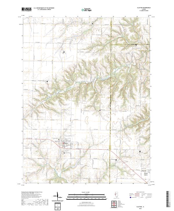
2024 Map of Clayton
USGS Topo · Published 2024About this map
The village of Clayton serves as the primary hub in this West Central Illinois landscape, situated where the borders of Adams, Schuyler, and Brown counties converge. This modern topographical record shows a region defined by agricultural grid roads and the intricate drainage of Missouri Creek and its various tributaries like South Fork Creek and Walnut Fork. For genealogists and local historians, the sheet is exceptionally well-indexed with burial sites, including the Old West Side Cem, South Side Cem, and more remote locations like Mount Horeb Cem and Sargent Cem. The southeastern corner features the community of Timewell, also identified by its older name Mound Station, adjacent to the Mounds Cem. The terrain transitions from flat till plains to the carved valleys of the Little Missouri Creek system, with Lake Clayton providing a central water feature just south of the main township.
Find a feature on this map
56 named features on this map. Tap any name to fly to it.
Don’t see what you’re looking for? This feature index may not catch every label — zoom into the map to look around manually.
Map Details
Editions of this 2024 Clayton Map
This is the sole edition of this map. No revisions or reprints were ever made.
Other maps of this area

1925 · Liberty
USGS Topo · 1:62,500

1926 · Mt Sterling
USGS Topo · 1:62,500

1927 · Liberty
USGS Topo · 1:62,500

1929 · Mt Sterling
USGS Topo · 1:62,500

1946 · Augusta
USGS Topo · 1:62,500

1948 · Quincy
USGS Topo · 1:250,000

1948 · Camp Point
USGS Topo · 1:62,500

1949 · Augusta
USGS Topo · 1:62,500

1956 · Quincy
USGS Topo · 1:250,000

1958 · Burlington
USGS Topo · 1:250,000