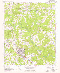
1964 Map of Clayton
USGS Topo · Published 1975About this map
The town of Clayton serves as the focal point of this Johnston County landscape, situated along the Southern railroad line during the mid-1960s. The area's agricultural and research character is well-defined by the large State Agricultural Experimental Station and the State Forestry Dept Nursery located to the northwest. These facilities highlight the regional importance of forestry and farming science in North Carolina during this era.
Find a feature on this map
46 named features on this map. Tap any name to fly to it.
Don’t see what you’re looking for? This feature index may not catch every label — zoom into the map to look around manually.
Map Details
Editions of this 1964 Clayton Map
3 editions found
Other maps of this area

1943 · Raleigh
USGS Topo · 1:62,500

1951 · Raleigh
USGS Topo · 1:62,500

1953 · Raleigh
USGS Topo · 1:250,000

1954 · Raleigh
USGS Topo · 1:250,000

1964 · Garner
USGS Topo · 1:24,000

1964 · Flowers
USGS Topo · 1:24,000

1964 · Selma
USGS Topo · 1:62,500

1964 · Clayton
USGS Topo · 1:24,000

1964 · Edmondson
USGS Topo · 1:24,000

1964 · Garner
USGS Topo · 1:62,500