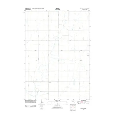
2012 Map of Clayton NE
USGS Topo · Published 2012About this map
Wolf Creek meanders through this agricultural section of Pleasant Township, defining the drainage patterns across a grid of rural roads. The landscape is characterized by its organized section lines, where 269th St and 270th St intersect north-south avenues like 431st Ave and 432nd Ave. Small creek beds such as Elm Creek break the geometric precision of the farm plots, revealing the natural hydrology that dictated early land use and homestead placement in Hutchinson County. For genealogists and local historians, the map provides precise locations for two distinct burial sites: Huber Cemetery in the southern portion and Kleinkassell Cemetery to the east. These small, rural cemeteries serve as primary landmarks in a region defined by its sparse, agrarian settlement pattern and open prairie vistas.
Find a feature on this map
18 named features on this map. Tap any name to fly to it.
Don’t see what you’re looking for? This feature index may not catch every label — zoom into the map to look around manually.
Map Details
Editions of this 2012 Clayton NE Map
This is the sole edition of this map. No revisions or reprints were ever made.
Other maps of this area

1898 · Olivet
USGS Topo · 1:125,000

1898 · Parker
USGS Topo · 1:125,000

1899 · Alexandria
USGS Topo · 1:125,000

1955 · Sioux Falls
USGS Topo · 1:250,000

1957 · Tschetter Colony
USGS Topo · 1:24,000

1957 · Clayton
USGS Topo · 1:24,000

1957 · Wolf Creek
USGS Topo · 1:24,000

1958 · Sioux Falls
USGS Topo · 1:250,000

1964 · Bridgewater East
USGS Topo · 1:24,000

1970 · Clayton NE
USGS Topo · 1:24,000
Featured Places
- Pleasant Township, SD
- Taylor Township, SD
- Grandview Township, SD
- Silver Lake Township, SD
- Wolf Creek Township, SD