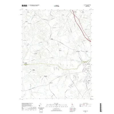
2019 Map of Clayton
USGS Topo · Published 2019About this map
Smyrna and Clayton anchor the southeastern corner of this study, marking a significant transition between the dense residential grid of these historic Kent County towns and the agricultural expanse of the Delmarva Peninsula. The landscape is defined by an intricate network of narrow waterways, including Cypress Br and the Sassafras River, which drain the low-lying northern fields. The distribution of small airfields like Spirit Airpark and Full Throttle Farm Airport suggests a modern reliance on local aviation alongside traditional farming. Genealogical interest is high throughout the rural northern reaches, where sites such as Ebenezer Cem and Salem Cem are located near long-established crossroads like Dexter Corners and Vandyke. This proximity of ancient burial grounds to contemporary airstrips highlights the layered history of a region where colonial-era settlement patterns still dictate the placement of roads and homesteads.
Find a feature on this map
104 named features on this map. Tap any name to fly to it.
Don’t see what you’re looking for? This feature index may not catch every label — zoom into the map to look around manually.
Map Details
Editions of this 2019 Clayton Map
This is the sole edition of this map. No revisions or reprints were ever made.
Other maps of this area

1899 · Dover
USGS Topo · 1:125,000

1900 · Cecilton
USGS Topo · 1:62,500

1905 · Barclay
USGS Topo · 1:62,500

1906 · Dover
USGS Topo · 1:125,000

1920 · Dover
USGS Topo · 1:125,000

1926 · Wyoming
USGS Topo · 1:48,000

1930 · Wyoming
USGS Topo · 1:62,500

1931 · Wyoming
USGS Topo · 1:62,500

1931 · Smyrna
USGS Topo · 1:62,500
1944 · Cecilton
USGS Topo · 1:31,680