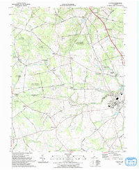
1993 Map of Clayton
USGS Topo · Published 1993About this map
Blackbird State Forest dominates the northern reaches of this Delaware landscape, where the New Castle Co Kent Co line divides a region of small settlements and corner communities. The area is defined by a dense network of country roads, such as Blackbird Station Road and Vandyke-Greensprings Road, connecting numerous named intersections like Grears Corners, Thomas Corners, and Holletts Corners. The town of Clayton serves as the local hub in the southeast, situated near the headwaters of Duck Creek.
Find a feature on this map
88 named features on this map. Tap any name to fly to it.
Don’t see what you’re looking for? This feature index may not catch every label — zoom into the map to look around manually.
Map Details
Editions of this 1993 Clayton Map
This is the sole edition of this map. No revisions or reprints were ever made.
Other maps of this area

1899 · Dover
USGS Topo · 1:125,000

1900 · Cecilton
USGS Topo · 1:62,500

1905 · Barclay
USGS Topo · 1:62,500

1906 · Dover
USGS Topo · 1:125,000

1920 · Dover
USGS Topo · 1:125,000

1926 · Wyoming
USGS Topo · 1:48,000

1930 · Wyoming
USGS Topo · 1:62,500

1931 · Wyoming
USGS Topo · 1:62,500

1931 · Smyrna
USGS Topo · 1:62,500
1944 · Cecilton
USGS Topo · 1:31,680