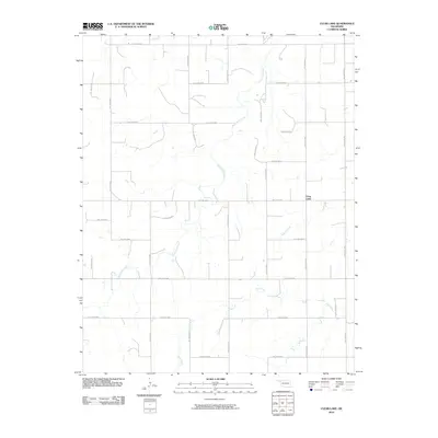
2010 Map of Clear Lake
USGS Topo · Published 2010About this map
Clear Lake sits within a sectioned landscape of Beaver County, Oklahoma, defined by the transition from high plains to the drainage networks of the eastern Panhandle. This 2010 survey illustrates a sparse settlement pattern where the primary geography is shaped by intermittent waterways like Duck Pond Creek and Mexico Creek. The map documents an extensive grid of section-line roads, many designated as hollows, such as Hollow N1530 and Hollow E0250, which facilitate movement through this cattle and agricultural country. To the south, Sand Creek weaves through the terrain, further highlighting the importance of seasonal water sources in this semi-arid region. The geometry of the road network, including routes like Hollow N1510, reflects the enduring legacy of the Public Land Survey System that carved this portion of Oklahoma into a precise checkerboard.
Find a feature on this map
28 named features on this map. Tap any name to fly to it.
Don’t see what you’re looking for? This feature index may not catch every label — zoom into the map to look around manually.
Map Details
Editions of this 2010 Clear Lake Map
This is the sole edition of this map. No revisions or reprints were ever made.
Other maps of this area

1954 · Perryton
USGS Topo · 1:250,000

1958 · Perryton
USGS Topo · 1:250,000

1970 · Knowles
USGS Topo · 1:24,000

1970 · Mocane SE
USGS Topo · 1:24,000

1971 · Clear Lake NW
USGS Topo · 1:24,000

1971 · Clear Lake SW
USGS Topo · 1:24,000

1971 · Clear Lake
USGS Topo · 1:24,000

1971 · Clear Lake SE
USGS Topo · 1:24,000

1971 · Logan
USGS Topo · 1:24,000

1971 · Logan NW
USGS Topo · 1:24,000