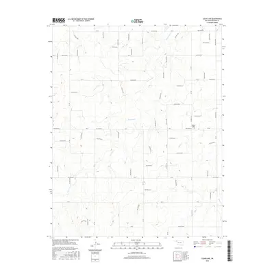
2016 Map of Clear Lake
USGS Topo · Published 2016About this map
Clear Lake sits in a high plains landscape defined by a remarkably precise grid of rural section roads and ephemeral watercourses in Beaver County. The terrain is drained by intermittent streams including Duck Pond Cr, Mexico Cr, and Sand Cr, which carve shallow depressions across the Oklahoma Panhandle. This 2016 survey illustrates the modern agricultural and ranching layout, where numbered routes like Ew 22 and Ew 25 provide access to the expansive rangelands. The map is particularly distinctive for its naming of numerous topographic features, such as Hollow N1530 and Hollow E0215, which appear as local identifiers for the subtle draws and drainage basins that characterize this part of the High Plains. These alphanumeric labels suggest a highly systematized approach to managing the vast, open acreage between the scattered water sources.
Find a feature on this map
56 named features on this map. Tap any name to fly to it.
Don’t see what you’re looking for? This feature index may not catch every label — zoom into the map to look around manually.
Map Details
Editions of this 2016 Clear Lake Map
This is the sole edition of this map. No revisions or reprints were ever made.
Other maps of this area

1954 · Perryton
USGS Topo · 1:250,000

1958 · Perryton
USGS Topo · 1:250,000

1970 · Knowles
USGS Topo · 1:24,000

1970 · Mocane SE
USGS Topo · 1:24,000

1971 · Clear Lake NW
USGS Topo · 1:24,000

1971 · Clear Lake SW
USGS Topo · 1:24,000

1971 · Clear Lake
USGS Topo · 1:24,000

1971 · Clear Lake SE
USGS Topo · 1:24,000

1971 · Logan
USGS Topo · 1:24,000

1971 · Logan NW
USGS Topo · 1:24,000