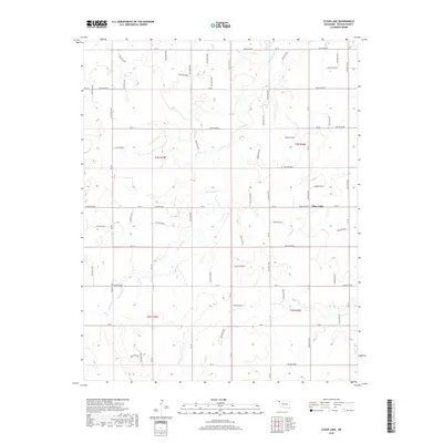
2018 Map of Clear Lake
USGS Topo · Published 2018About this map
Clear Lake sits in the eastern reaches of the Oklahoma Panhandle, serving as a localized point of interest in a landscape defined by the Public Land Survey System and a network of named drainages. This 2018 survey illustrates the rural character of Beaver County, where the topography is shaped by watercourses like Duck Pond Cr and Mexico Cr that carve through the high plains. The map is notably dense with alphanumeric identifiers for physical features, such as Hollow E0180 and Hollow N1500, which suggest a highly organized system of land management or geographic tracking in this portion of the state. To the south, Sand Cr winds through Township 2 North, intersecting a grid of section lines and local roads like NS 151 and Ew 24 that facilitate transport across this expansive agricultural and grazing region.
Find a feature on this map
67 named features on this map. Tap any name to fly to it.
Don’t see what you’re looking for? This feature index may not catch every label — zoom into the map to look around manually.
Map Details
Editions of this 2018 Clear Lake Map
This is the sole edition of this map. No revisions or reprints were ever made.
Other maps of this area

1954 · Perryton
USGS Topo · 1:250,000

1958 · Perryton
USGS Topo · 1:250,000

1970 · Knowles
USGS Topo · 1:24,000

1970 · Mocane SE
USGS Topo · 1:24,000

1971 · Clear Lake NW
USGS Topo · 1:24,000

1971 · Clear Lake SW
USGS Topo · 1:24,000

1971 · Clear Lake
USGS Topo · 1:24,000

1971 · Clear Lake SE
USGS Topo · 1:24,000

1971 · Logan
USGS Topo · 1:24,000

1971 · Logan NW
USGS Topo · 1:24,000