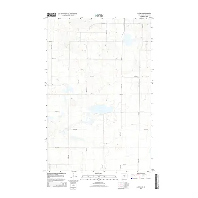
2014 Map of Clear Lake
USGS Topo · Published 2014About this map
Clear Lake serves as the central hydrographic feature of this landscape in Burleigh County, surrounded by a precise grid of sectional roads that define the rural character of the region. The map reveals an area organized by a high-density network of numbered thoroughfares, such as 175th Ave NE and 405th St NE, which facilitate access across the prairie terrain. This systematic layout is typical of the North Dakota interior, where the land is partitioned for agricultural and residential use. Aside from the primary lake, several smaller, unnamed seasonal wetlands and depressions are scattered throughout the quadrangle, indicating the prairie pothole geography common to this part of the state. The infrastructure documented here, including 110th Ave NE and 379th St NE, reflects the modern connectivity of this rural sector as it appeared during the 2014 survey.
Find a feature on this map
16 named features on this map. Tap any name to fly to it.
Don’t see what you’re looking for? This feature index may not catch every label — zoom into the map to look around manually.
Map Details
Editions of this 2014 Clear Lake Map
This is the sole edition of this map. No revisions or reprints were ever made.
Other maps of this area

1951 · McKenzie
USGS Topo · 1:62,500

1951 · Driscoll
USGS Topo · 1:62,500

1954 · Bismarck
USGS Topo · 1:250,000

1954 · McClusky
USGS Topo · 1:250,000

1958 · Bismarck
USGS Topo · 1:250,000

1958 · McClusky
USGS Topo · 1:250,000

1975 · Sibley Butte
USGS Topo · 1:24,000

1975 · Sterling
USGS Topo · 1:24,000

1975 · Lake Geneva
USGS Topo · 1:24,000

1975 · Wing SE
USGS Topo · 1:24,000