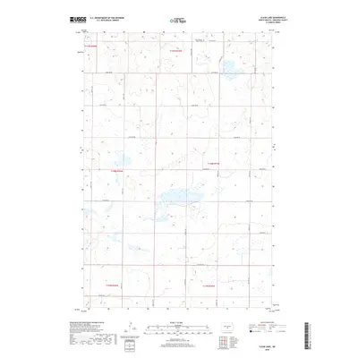
2018 Map of Clear Lake
USGS Topo · Published 2018About this map
Clear Lake sits at the center of this prairie landscape in Burleigh County, surrounded by an intricate network of wetlands and potholes characteristic of the North Dakota glacial till plain. The area is organized by a strict grid of township and range lines, including T140n R75w and T141n R75w, where section roads like 175th Ave NE provide access to the remote agricultural allotments. Cultural landmarks are concentrated in the northern sections, most notably the Zion Lutheran Church and the adjacent Zion Lutheran Cem. This map illustrates the persistent 19th-century land survey patterns that continue to dictate the placement of rural residences and religious centers in the 21st century. The terrain is relatively flat, punctuated by small depressions and marshes that define the drainage patterns between the various sections of Burleigh County.
Find a feature on this map
24 named features on this map. Tap any name to fly to it.
Don’t see what you’re looking for? This feature index may not catch every label — zoom into the map to look around manually.
Map Details
Editions of this 2018 Clear Lake Map
This is the sole edition of this map. No revisions or reprints were ever made.
Other maps of this area

1951 · McKenzie
USGS Topo · 1:62,500

1951 · Driscoll
USGS Topo · 1:62,500

1954 · Bismarck
USGS Topo · 1:250,000

1954 · McClusky
USGS Topo · 1:250,000

1958 · Bismarck
USGS Topo · 1:250,000

1958 · McClusky
USGS Topo · 1:250,000

1975 · Sibley Butte
USGS Topo · 1:24,000

1975 · Sterling
USGS Topo · 1:24,000

1975 · Lake Geneva
USGS Topo · 1:24,000

1975 · Wing SE
USGS Topo · 1:24,000