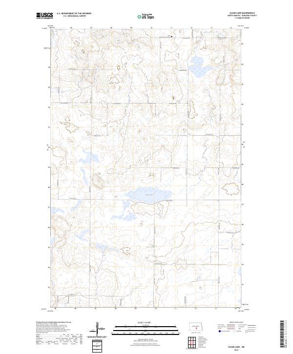
2024 Map of Clear Lake
USGS Topo · Published 2024About this map
Clear Lake dominates the central landscape of this rural North Dakota interior, situated amidst the township boundaries of t140n r75w and t140n r76w. The terrain is defined by a high concentration of small wetlands and depressions characteristic of the Missouri Coteau region. Human settlement is sparse, organized around a rigid section-line road network that includes thoroughfares like 175th Ave NE and 379th St NE. In the northern portion of the quadrangle, the Zion Lutheran Church stands near a small Cem, serving as a localized social and genealogical anchor for the surrounding agricultural community. The map's grid of avenues and streets, from 84th Ave NE to 405th St NE, illustrates the enduring structure of the Public Land Survey System in Burleigh County.
Find a feature on this map
24 named features on this map. Tap any name to fly to it.
Don’t see what you’re looking for? This feature index may not catch every label — zoom into the map to look around manually.
Map Details
Editions of this 2024 Clear Lake Map
This is the sole edition of this map. No revisions or reprints were ever made.
Other maps of this area

1951 · McKenzie
USGS Topo · 1:62,500

1951 · Driscoll
USGS Topo · 1:62,500

1954 · Bismarck
USGS Topo · 1:250,000

1954 · McClusky
USGS Topo · 1:250,000

1958 · Bismarck
USGS Topo · 1:250,000

1958 · McClusky
USGS Topo · 1:250,000

1975 · Sibley Butte
USGS Topo · 1:24,000

1975 · Sterling
USGS Topo · 1:24,000

1975 · Lake Geneva
USGS Topo · 1:24,000

1975 · Wing SE
USGS Topo · 1:24,000