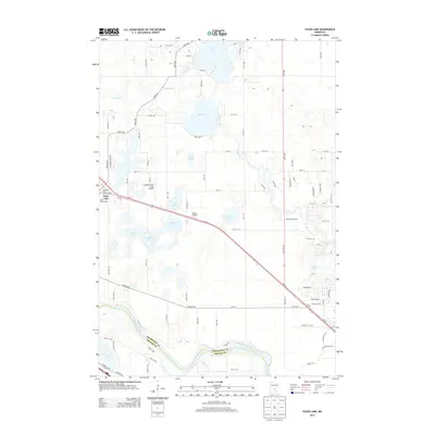
2013 Map of Clear Lake
USGS Topo · Published 2013About this map
The Mississippi River forms a wide, sweeping boundary between Sherburne Co and Wright Co in this detailed survey of central Minnesota. The settlement of Clear Lake sits in the western portion of the map, serving as a hub for the surrounding lakeland and agricultural tracts. This landscape is defined by its numerous water bodies, ranging from the large Elk Lake and Julia Lake in the north to smaller basins like Camp Lake and Mosford Lake further south. The transportation corridor follows the path of the river, with various roads and rural infrastructure connecting the town to regional transit points. Aviation and community spaces are well-documented here, featuring the Leaders/Clear Lake Airport, Miller Airport, and the Airstream Park PO. For those tracing local history, the Saint Marcus Cem remains a primary landmark near the town center, while recreation sites such as Riverwood RV Park highlight the area's modern land use near the river's edge.
Find a feature on this map
86 named features on this map. Tap any name to fly to it.
Don’t see what you’re looking for? This feature index may not catch every label — zoom into the map to look around manually.
Map Details
Editions of this 2013 Clear Lake Map
This is the sole edition of this map. No revisions or reprints were ever made.
Other maps of this area

1950 · St. Cloud
USGS Topo · 1:62,500

1951 · Annandale
USGS Topo · 1:62,500

1953 · Saint Cloud
USGS Topo · 1:250,000

1953 · Stillwater
USGS Topo · 1:250,000

1955 · Stillwater
USGS Topo · 1:250,000

1957 · Saint Cloud
USGS Topo · 1:250,000

1958 · Stillwater
USGS Topo · 1:250,000

1958 · Saint Cloud
USGS Topo · 1:250,000

1961 · Clear Lake
USGS Topo · 1:24,000

1961 · Silver Creek
USGS Topo · 1:24,000