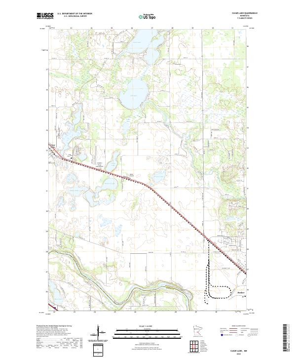
2022 Map of Clear Lake
USGS Topo · Published 2022About this map
Clear Lake and Becker anchor this Sherburne County landscape as it appeared in the early 21st century, defined by a complex network of glacial lakes and the winding path of the Mississippi River. The terrain is characterized by numerous water bodies including Elk Lake, Julia Lake, and Prairie Lake, which are interconnected by smaller tributaries like Lilly Creek. Transportation infrastructure is a prominent feature, with state roads and local routes like Co RD 54 and Co RD 16 weaving through the lakeland, while aviation needs are served by Leaders Clear Lake Airport and Miller Airport. For those researching local history or genealogy, the map identifies significant sites such as Saint Marcus Cem and Clear Lake Cem. The southern border follows the river, where the Mississippi River Trl traces the county line between Sherburne and Wright counties, illustrating how the river continues to shape the region's recreational and administrative boundaries.
Find a feature on this map
84 named features on this map. Tap any name to fly to it.
Don’t see what you’re looking for? This feature index may not catch every label — zoom into the map to look around manually.
Map Details
Editions of this 2022 Clear Lake Map
This is the sole edition of this map. No revisions or reprints were ever made.
Other maps of this area

1950 · St. Cloud
USGS Topo · 1:62,500

1951 · Annandale
USGS Topo · 1:62,500

1953 · Saint Cloud
USGS Topo · 1:250,000

1953 · Stillwater
USGS Topo · 1:250,000

1955 · Stillwater
USGS Topo · 1:250,000

1957 · Saint Cloud
USGS Topo · 1:250,000

1958 · Stillwater
USGS Topo · 1:250,000

1958 · Saint Cloud
USGS Topo · 1:250,000

1961 · Clear Lake
USGS Topo · 1:24,000

1961 · Silver Creek
USGS Topo · 1:24,000