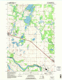
1991 Map of Clear Lake
USGS Topo · Published 1995About this map
The Mississippi River and the Elk River define the hydraulic character of this Sherburne County landscape, where the prairie gives way to a dense network of glacial lakes. In the early 1990s, the settlements of Clear Lake and Becker serve as the primary hubs, connected by a prominent diagonal transportation corridor that cuts through Palmer and Becker townships. This 1991 revision, based on imagery dating back to 1958, captures a rural environment in transition, showing the scattered farmsteads and small-town footprints of Clearwater along the riverbanks.
Find a feature on this map
26 named features on this map. Tap any name to fly to it.
Don’t see what you’re looking for? This feature index may not catch every label — zoom into the map to look around manually.
Map Details
Editions of this 1991 Clear Lake Map
This is the sole edition of this map. No revisions or reprints were ever made.
Other maps of this area

1950 · St. Cloud
USGS Topo · 1:62,500

1951 · Annandale
USGS Topo · 1:62,500

1953 · Saint Cloud
USGS Topo · 1:250,000

1953 · Stillwater
USGS Topo · 1:250,000

1955 · Stillwater
USGS Topo · 1:250,000

1957 · Saint Cloud
USGS Topo · 1:250,000

1958 · Stillwater
USGS Topo · 1:250,000

1958 · Saint Cloud
USGS Topo · 1:250,000

1961 · Clear Lake
USGS Topo · 1:24,000

1961 · Silver Creek
USGS Topo · 1:24,000