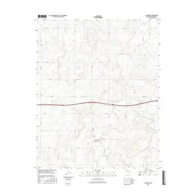
2016 Map of Clearview
USGS Topo · Published 2016About this map
Clearview stands as a focal point in this eastern Oklahoma landscape, positioned near the intersection of Main St and 3836 Rd. This 2016 survey captures the rural layout of Okfuskee County, where the settlement is surrounded by family-named landmarks and historical burial sites including French Cem and Clearview Cem. The terrain is defined by a dendritic drainage pattern where Alabama Cr and Philadelphia Cr move through the rolling country, occasionally widening into designated water bodies like Oknoname 107026 Reservoir.
Find a feature on this map
33 named features on this map. Tap any name to fly to it.
Don’t see what you’re looking for? This feature index may not catch every label — zoom into the map to look around manually.
Map Details
Editions of this 2016 Clearview Map
This is the sole edition of this map. No revisions or reprints were ever made.
Other maps of this area

1900 · Wewoka
USGS Topo · 1:125,000

1901 · Nuyaka
USGS Topo · 1:125,000

1954 · Oklahoma City
USGS Topo · 1:250,000

1957 · Oklahoma City
USGS Topo · 1:250,000

1963 · Oklahoma City
USGS Topo · 1:250,000
1967 · Pharoah
USGS Topo · 1:24,000

1967 · Okemah SE
USGS Topo · 1:24,000

1967 · Weleetka
USGS Topo · 1:24,000

1967 · Okemah
USGS Topo · 1:24,000
1967 · Clearview
USGS Topo · 1:24,000