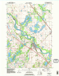
1991 Map of Clearwater
USGS Topo · Published 1995About this map
The Mississippi River winds through the heart of this landscape, serving as a jurisdictional anchor where the boundaries of Sherburne, Stearns, and Wright counties converge. The town of Clearwater sits at the strategic confluence of the Mississippi and the Clearwater River, showing a development pattern influenced by the interstate and regional river access. To the north, the community of Clear Lake is surrounded by a dense cluster of glacial water bodies, including Stickney Lake, Long Lake, and Cater Lake, illustrating the post-glacial topography of the Haven and Clear Lake townships. Local history is anchored by several rural burial grounds such as St Luke Cem, Mt Hope Cem, and Acacia Cem. The map captures the area as it transitioned from traditional river-town life to a more connected regional hub in the early 1990s.
Find a feature on this map
34 named features on this map. Tap any name to fly to it.
Don’t see what you’re looking for? This feature index may not catch every label — zoom into the map to look around manually.
Map Details
Editions of this 1991 Clearwater Map
This is the sole edition of this map. No revisions or reprints were ever made.
Other maps of this area

1950 · St. Cloud
USGS Topo · 1:62,500

1951 · Annandale
USGS Topo · 1:62,500

1953 · Saint Cloud
USGS Topo · 1:250,000

1953 · Stillwater
USGS Topo · 1:250,000

1955 · Stillwater
USGS Topo · 1:250,000

1957 · Saint Cloud
USGS Topo · 1:250,000

1958 · Stillwater
USGS Topo · 1:250,000

1958 · Saint Cloud
USGS Topo · 1:250,000

1961 · Clear Lake
USGS Topo · 1:24,000

1961 · Silver Creek
USGS Topo · 1:24,000