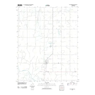
2009 Map of Cleo Springs
USGS Topo · Published 2009About this map
Cleo Springs serves as the central hub of this Major County landscape, where the town grid is established just north of the Cimarron River. The geography is defined by the winding course of Eagle Chief Creek, which meanders from the northwest corner of the quadrangle down toward the river valley. The map reveals a highly structured section-line road network, including n2550 RD and e0400 RD, which facilitates movement between the town and surrounding agricultural lands. To the north of the main settlement, the Oknoname 093002 Dam and its associated Oknoname 093002 Reservoir provide a localized water management point. Genealogists and local historians will find the location of the Cleo Springs Cemetery east of the town center particularly useful for tracing family lineages in this part of Oklahoma.
Find a feature on this map
24 named features on this map. Tap any name to fly to it.
Don’t see what you’re looking for? This feature index may not catch every label — zoom into the map to look around manually.
Map Details
Editions of this 2009 Cleo Springs Map
This is the sole edition of this map. No revisions or reprints were ever made.
Other maps of this area

1955 · Woodward
USGS Topo · 1:250,000

1958 · Woodward
USGS Topo · 1:250,000

1968 · Carmen
USGS Topo · 1:24,000

1969 · Fairview NE
USGS Topo · 1:24,000

1969 · Helena
USGS Topo · 1:24,000

1969 · Glass Mountains
USGS Topo · 1:24,000

1969 · Fairview SE
USGS Topo · 1:24,000

1969 · Fairview
USGS Topo · 1:24,000

1969 · Cleo Springs
USGS Topo · 1:24,000

1969 · Glass Mountains NE
USGS Topo · 1:24,000