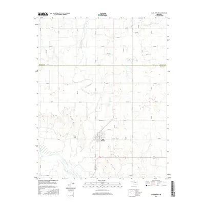
2016 Map of Cleo Springs
USGS Topo · Published 2016About this map
Cleo Springs sits at the heart of this landscape, positioned north of the wide Cimarron River in northwestern Oklahoma. The settlement is defined by a grid of streets including Nebraska St and Oklahoma St, with the nearby West Cleo adding to the localized residential footprint. This area, situated along the border of Alfalfa Co and Major Co, is characterized by a dense network of section-line roads such as Shoestring Rd and Heritage Rd, reflecting the region's agricultural history. The winding course of Eagle Chief Creek cuts through the northern sections, creating a natural contrast to the rigid geometry of the surrounding farmland. Genealogists and local historians can find the Cleo Springs Cem located just east of the main town site, offering a tangible link to the families who settled this part of the state.
Find a feature on this map
36 named features on this map. Tap any name to fly to it.
Don’t see what you’re looking for? This feature index may not catch every label — zoom into the map to look around manually.
Map Details
Editions of this 2016 Cleo Springs Map
This is the sole edition of this map. No revisions or reprints were ever made.
Other maps of this area

1955 · Woodward
USGS Topo · 1:250,000

1958 · Woodward
USGS Topo · 1:250,000

1968 · Carmen
USGS Topo · 1:24,000

1969 · Fairview NE
USGS Topo · 1:24,000

1969 · Helena
USGS Topo · 1:24,000

1969 · Glass Mountains
USGS Topo · 1:24,000

1969 · Fairview SE
USGS Topo · 1:24,000

1969 · Fairview
USGS Topo · 1:24,000

1969 · Cleo Springs
USGS Topo · 1:24,000

1969 · Glass Mountains NE
USGS Topo · 1:24,000