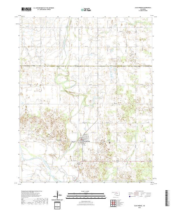
2022 Map of Cleo Springs
USGS Topo · Published 2022About this map
Cleo Springs sits at the heart of this North Central Oklahoma landscape, where the flat plains of the Cherokee Outlet meet the southern sweep of the Cimarron River. The town's grid is meticulously detailed, showing a network of streets including Nebraska St, Oklahoma St, and Texas St. Just to the west, the smaller settlement of West Cleo and the Eagle Chief Airport provide evidence of local transport and decentralized growth patterns typical of this rural region. The landscape is defined by the meandering course of Eagle Chief Creek, which carves through the township lines of Alfalfa and Major counties. Water management is visible through features like the 093002 Reservoir, while the local heritage is anchored by the Cleo Springs Cem located east of the main town site, offering a precise resource for genealogical research in this farming community.
Find a feature on this map
49 named features on this map. Tap any name to fly to it.
Don’t see what you’re looking for? This feature index may not catch every label — zoom into the map to look around manually.
Map Details
Editions of this 2022 Cleo Springs Map
This is the sole edition of this map. No revisions or reprints were ever made.
Other maps of this area

1955 · Woodward
USGS Topo · 1:250,000

1958 · Woodward
USGS Topo · 1:250,000

1968 · Carmen
USGS Topo · 1:24,000

1969 · Fairview NE
USGS Topo · 1:24,000

1969 · Helena
USGS Topo · 1:24,000

1969 · Glass Mountains
USGS Topo · 1:24,000

1969 · Fairview SE
USGS Topo · 1:24,000

1969 · Fairview
USGS Topo · 1:24,000

1969 · Cleo Springs
USGS Topo · 1:24,000

1969 · Glass Mountains NE
USGS Topo · 1:24,000