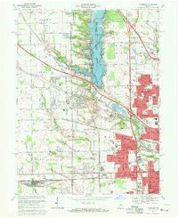
1967 Map of Clermont
USGS Topo · Published 1969About this map
Eagle Creek Reservoir dominates the landscape west of Indianapolis, a massive civil engineering project that significantly altered the drainage of Eagle Creek and its many tributaries like Dandy Creek and Lilly Lake. In the late 1960s, the western edge of the metropolitan area shows a distinct transition from the dense street grids of Speedway and Farleys Addition to the sprawling industrial and recreational complexes like the Big Four Yard rail facility and the Indianapolis Raceway Park.
Find a feature on this map
136 named features on this map. Tap any name to fly to it.
Don’t see what you’re looking for? This feature index may not catch every label — zoom into the map to look around manually.
Map Details
Editions of this 1967 Clermont Map
3 editions found
Other maps of this area

1948 · Maywood
USGS Topo · 1:24,000

1948 · Indianapolis West
USGS Topo · 1:24,000

1952 · Carmel
USGS Topo · 1:24,000

1953 · Bridgeport
USGS Topo · 1:24,000

1953 · Fayette
USGS Topo · 1:24,000

1953 · Brownsburg
USGS Topo · 1:24,000

1953 · Zionsville
USGS Topo · 1:24,000

1953 · Plainfield
USGS Topo · 1:24,000

1953 · Clermont
USGS Topo · 1:24,000

1953 · Indianapolis
USGS Topo · 1:250,000