
1966 Map of Cleveland
USGS Topo · Published 1967About this map
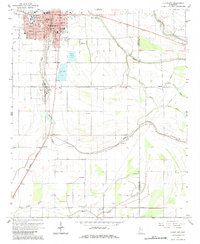
Cleveland and the surrounding Bolivar County delta lands are anchored by the campus of Delta State College and the north-south corridor of the Illinois Central railroad. The landscape is defined by the winding paths of Jones Bayou and the Sunflower River, which border a productive agricultural interior dotted with rural congregations like New Bethel Ch and White Star Ch. In town, the map documents the growth of the mid-1960s, showing the concentration of civic life around the Courthouse, Sillers Coliseum, and East Side High Sch. Outside the city limits, specialized land use is evident in the Fish Farm and various sandpits. This survey captures a moment when smaller settlements like Boyle, O'Reilly, and Porter still maintained distinct identities along the rail and bayou networks.
Find a feature on this map
41 named features on this map. Tap any name to fly to it.
Don’t see what you’re looking for? This feature index may not catch every label — zoom into the map to look around manually.
Map Details
Editions of this 1966 Cleveland Map
2 editions found
Other maps of this area

1931 · Drew
USGS Topo · 1:48,000

1934 · Cleveland
USGS Topo · 1:62,500

1935 · Mound Bayou
USGS Topo · 1:62,500

1939 · Pace
USGS Topo · 1:62,500

1939 · Choctaw
USGS Topo · 1:62,500

1940 · Cleveland
USGS Topo · 1:62,500

1953 · Greenwood
USGS Topo · 1:250,000

1956 · Greenwood
USGS Topo · 1:250,000
1966 · Merigold
USGS Topo · 1:24,000
1966 · Drew
USGS Topo · 1:24,000