
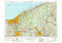
1956 Map of Cleveland
USGS Topo · Published 1967About this map
Industrial and urban expansion across Northeast Ohio and Western Pennsylvania defines this mid-century survey. The landscape is anchored by the massive metropolitan centers of Cleveland, Akron, and Youngstown, interconnected by a dense network of transit infrastructure including the Ohio Turnpike and major rail lines like the Erie RR and B & O RR. This era shows the heavy footprint of wartime and post-war production, evidenced by the sprawling Ravenna Arsenal and Keystone Ordnance Works, which occupied significant acreage between established settlements.
Find a feature on this map
170 named features on this map. Tap any name to fly to it.
Don’t see what you’re looking for? This feature index may not catch every label — zoom into the map to look around manually.
Map Details
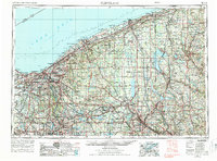
Editions of this 1956 Cleveland Map
3 editions found
Other maps of this area

1899 · Erie
USGS Topo · 1:62,500

1900 · Girard
USGS Topo · 1:62,500

1900 · Erie
USGS Topo · 1:62,500

1900 · Fairview
USGS Topo · 1:62,500

1901 · Oberlin
USGS Topo · 1:62,500

1901 · Massillon
USGS Topo · 1:62,500

1901 · Canton
USGS Topo · 1:62,500

1901 · Wooster
USGS Topo · 1:62,500

1901 · Euclid
USGS Topo · 1:62,500

1902 · New Castle
USGS Topo · 1:62,500