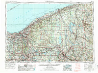
1956 Map of Cleveland
USGS Topo · Published 1988About this map
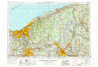
Lake Erie defines the northern horizon of this mid-century landscape, anchoring a dense network of industrial centers and water management systems. From the urban core of Cleveland and its suburban ring including Lakewood and Shaker Heights, the map traces the vital transportation corridors of the Ohio Turnpike and rail lines like the Erie Lackawanna. To the south and east, the industrial strength of Akron, Youngstown, and New Castle is evident, supported by a complex of man-made water bodies such as Mosquito Creek Lake and Berlin Reservoir.
Find a feature on this map
104 named features on this map. Tap any name to fly to it.
Don’t see what you’re looking for? This feature index may not catch every label — zoom into the map to look around manually.
Map Details
Editions of this 1956 Cleveland Map
3 editions found

Other maps of this area

1899 · Erie
USGS Topo · 1:62,500

1900 · Girard
USGS Topo · 1:62,500

1900 · Erie
USGS Topo · 1:62,500

1900 · Fairview
USGS Topo · 1:62,500

1901 · Oberlin
USGS Topo · 1:62,500

1901 · Massillon
USGS Topo · 1:62,500

1901 · Canton
USGS Topo · 1:62,500

1901 · Wooster
USGS Topo · 1:62,500

1901 · Euclid
USGS Topo · 1:62,500

1902 · New Castle
USGS Topo · 1:62,500