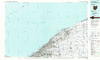
1985 Map of Cleveland North
USGS Topo · Published 1986About this map
Lake Erie defines the northern reaches of this mid-1980s coastal study, stretching from the urban core of Cleveland eastward through the growing suburbs of Euclid and Mentor. This era shows a dense network of industrial and transport infrastructure, where the Conrail and Norfolk And Western railroads parallel the shoreline, supporting the region's manufacturing legacy. The map captures the transition from heavy industry to public recreation, evidenced by the large footprints of Cleveland Lakefront State Park and Headlands Beach State Park.
Find a feature on this map
83 named features on this map. Tap any name to fly to it.
Don’t see what you’re looking for? This feature index may not catch every label — zoom into the map to look around manually.
Map Details
Editions of this 1985 Cleveland North Map
This is the sole edition of this map. No revisions or reprints were ever made.
Other maps of this area

1901 · Oberlin
USGS Topo · 1:62,500

1901 · Euclid
USGS Topo · 1:62,500

1902 · Berea
USGS Topo · 1:62,500

1903 · Cleveland
USGS Topo · 1:62,500

1903 · Euclid
USGS Topo · 1:62,500

1903 · Oberlin
USGS Topo · 1:62,500

1904 · Berea
USGS Topo · 1:62,500

1904 · Chardon
USGS Topo · 1:62,500

1905 · Ashtabula
USGS Topo · 1:62,500

1905 · Perry
USGS Topo · 1:62,500