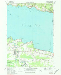
1973 Map of Cleveland
USGS Topo · Published 1984About this map
Oneida Lake dominates this mid-1970s survey, with the Erie Canal route clearly indicated through its central waters. Along the northern shoreline, the lakeside villages of Constantia, Bernhards Bay, and Cleveland follow the path of an Old RR Grade, reflecting the historical importance of rail transit along the waterfront. To the south, the landscape transitions into the wetlands of Cicero Swamp and the protected lands of the Cicero State Game Management Area, highlighting the contrast between settled lakefront communities and the preserved natural environment.
Find a feature on this map
66 named features on this map. Tap any name to fly to it.
Don’t see what you’re looking for? This feature index may not catch every label — zoom into the map to look around manually.
Map Details
Editions of this 1973 Cleveland Map
Other maps of this area

1895 · Chittenango
USGS Topo · 1:62,500

1895 · Syracuse
USGS Topo · 1:62,500

1898 · Syracuse
USGS Topo · 1:62,500

1898 · Chittenango
USGS Topo · 1:62,500

1902 · Chittenango
USGS Topo · 1:62,500

1905 · Mexico
USGS Topo · 1:62,500

1906 · Kasoag
USGS Topo · 1:62,500

1938 · Syracuse East
USGS Topo · 1:24,000

1940 · Cicero
USGS Topo · 1:24,000

1941 · Cleveland
USGS Topo · 1:24,000