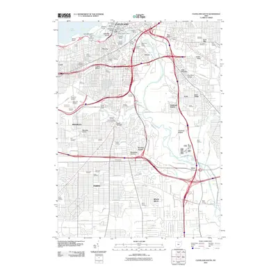
2010 Map of Cleveland South
USGS Topo · Published 2010About this map
The Cuyahoga River carves a complex industrial and cultural path through this urban landscape, defining the sharp turns of Collision Bend and Ox Bow Bend. This area of Cleveland is a mosaic of distinct ethnic and historical neighborhoods, including Slavic Village, Little Bohemia, Dutch Alley, and The Angle. The industrial legacy of the riverfront is evident at Whiskey Island and the Union Stockyards, while the city's civic history is anchored by Moses Cleveland Landing and the Union Terminal.
Find a feature on this map
113 named features on this map. Tap any name to fly to it.
Don’t see what you’re looking for? This feature index may not catch every label — zoom into the map to look around manually.
Map Details
Editions of this 2010 Cleveland South Map
This is the sole edition of this map. No revisions or reprints were ever made.
Other maps of this area

1901 · Euclid
USGS Topo · 1:62,500

1902 · Berea
USGS Topo · 1:62,500

1903 · Cleveland
USGS Topo · 1:62,500

1903 · Euclid
USGS Topo · 1:62,500

1904 · Berea
USGS Topo · 1:62,500

1950 · Cleveland
USGS Topo · 1:250,000

1953 · Shaker Heights
USGS Topo · 1:24,000

1953 · Broadview Heights
USGS Topo · 1:24,000

1953 · Berea
USGS Topo · 1:24,000

1953 · East Cleveland
USGS Topo · 1:24,000