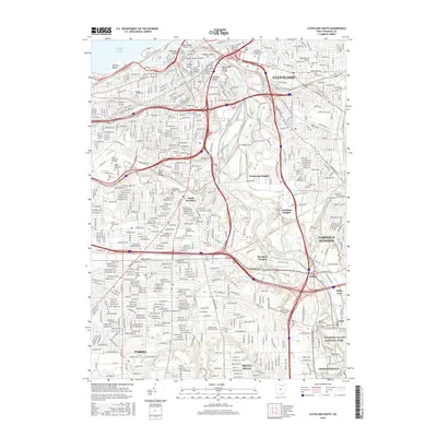
2016 Map of Cleveland South
USGS Topo · Published 2016About this map
The winding Cuyahoga River defines the industrial and geographic heart of this 2016 survey, carving through the famous urban bends of The Flats, including Collision Bend and Ox Bow Bend. The map documents the intricate transportation network of south Cleveland, where numerous crossings like the Hope Memorial Bridge and Innerbelt Bridge span the river valley to connect neighborhoods like South Brooklyn and Newburgh Heights. This industrial corridor is heavily shaped by the Norfolk Southern rail lines that thread through the valley alongside Morgan Run and Big Creek.
Find a feature on this map
77 named features on this map. Tap any name to fly to it.
Don’t see what you’re looking for? This feature index may not catch every label — zoom into the map to look around manually.
Map Details
Editions of this 2016 Cleveland South Map
This is the sole edition of this map. No revisions or reprints were ever made.
Other maps of this area

1901 · Euclid
USGS Topo · 1:62,500

1902 · Berea
USGS Topo · 1:62,500

1903 · Cleveland
USGS Topo · 1:62,500

1903 · Euclid
USGS Topo · 1:62,500

1904 · Berea
USGS Topo · 1:62,500

1950 · Cleveland
USGS Topo · 1:250,000

1953 · Shaker Heights
USGS Topo · 1:24,000

1953 · Broadview Heights
USGS Topo · 1:24,000

1953 · Berea
USGS Topo · 1:24,000

1953 · East Cleveland
USGS Topo · 1:24,000