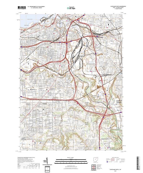
2023 Map of Cleveland South
USGS Topo · Published 2023About this map
The Cuyahoga River carves a winding path through the industrial heart of Cleveland, creating distinct geographic markers like Irishtown Bend and Ox Bow Bend. This 2023 survey illustrates the dense urban and suburban landscape south of Lake Erie, where residential neighborhoods in South Brooklyn and Parma transition into the preserved green space of the Cuyahoga Valley National Park. The map's detail is particularly valuable for genealogists, as it documents numerous historic burial grounds including the Woodland Cem Soldiers' Lot and the Erie Street Cem located near The Flats. Infrastructure and industry dominate the corridor, showing the Norfolk Southern rail lines and the complex highway network of I-77 and I-480 that services the surrounding communities of Newburgh Heights and Cuyahoga Heights.
Find a feature on this map
54 named features on this map. Tap any name to fly to it.
Don’t see what you’re looking for? This feature index may not catch every label — zoom into the map to look around manually.
Map Details
Editions of this 2023 Cleveland South Map
This is the sole edition of this map. No revisions or reprints were ever made.
Other maps of this area

1901 · Euclid
USGS Topo · 1:62,500

1902 · Berea
USGS Topo · 1:62,500

1903 · Cleveland
USGS Topo · 1:62,500

1903 · Euclid
USGS Topo · 1:62,500

1904 · Berea
USGS Topo · 1:62,500

1950 · Cleveland
USGS Topo · 1:250,000

1953 · Shaker Heights
USGS Topo · 1:24,000

1953 · Broadview Heights
USGS Topo · 1:24,000

1953 · Berea
USGS Topo · 1:24,000

1953 · East Cleveland
USGS Topo · 1:24,000