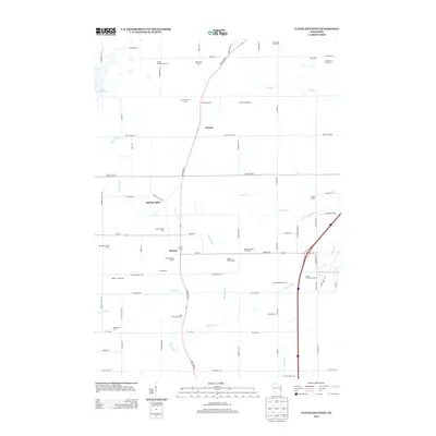
2013 Map of Cleveland West
USGS Topo · Published 2013About this map
Dairy farming defines the character of this Manitowoc County landscape, where family-named operations like Grotegut Dairy Farm and the Saxon Homestead Farm neighbor established settlements. The community of Osman sits at the junction of State Road 42 and Point Creek Rd, while further south, the Meeme River winds past the hamlet of Meeme. The map reveals a high density of specialized agricultural sites, including the Circle B Bison Ranch and numerous dairy facilities such as Long View Dairy Farm and Soaring Eagle Dairy. These farmsteads are connected by a network of rural routes, including County Hwy-X and Spring Valley Rd, which bridge the drainage basins of the Pigeon River and Centerville Cr. This 2013 survey provides a detailed record of modern Wisconsin agriculture, marking individual properties like Bonde Acres and Siemers Holstein Farms that illustrate the area's continued reliance on the land.
Find a feature on this map
69 named features on this map. Tap any name to fly to it.
Don’t see what you’re looking for? This feature index may not catch every label — zoom into the map to look around manually.
Map Details
Editions of this 2013 Cleveland West Map
This is the sole edition of this map. No revisions or reprints were ever made.
Other maps of this area

1954 · School Hill
USGS Topo · 1:24,000

1954 · Manitowoc
USGS Topo · 1:62,500

1954 · Cleveland
USGS Topo · 1:24,000

1954 · St. Wendel
USGS Topo · 1:24,000

1954 · Sheboygan North
USGS Topo · 1:62,500

1954 · Sheboygan North
USGS Topo · 1:24,000

1954 · Howards Grove
USGS Topo · 1:62,500

1954 · Howards Grove
USGS Topo · 1:24,000

1954 · Reedsville
USGS Topo · 1:62,500

1954 · Manitowoc
USGS Topo · 1:24,000