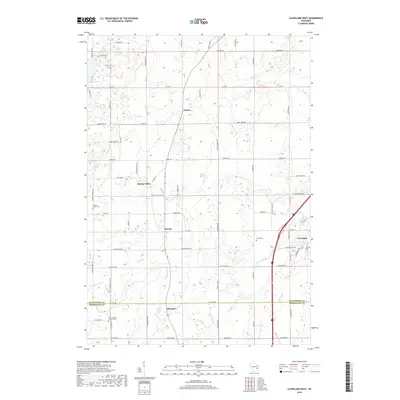
2018 Map of Cleveland West
USGS Topo · Published 2018About this map
Osman and Meeme anchor a landscape defined by traditional Wisconsin dairy country and small crossroad hamlets. This 2018 survey documents the persistent agricultural character of the region, where family-named roads like Schuette Rd and Borgwardt Rd connect long-standing homesteads to local centers like Spring Valley. The map detail follows the many drainages that carve through the glacial till, including Fischer Cr, Point Cr, and the Meeme River, which eventually flow toward Lake Michigan to the east. For genealogists, the map provides precise locations for several burial sites including Meeme Center Cem, Saxon Cem, and Saint Joseph's Catholic Cem near the southern border at Edwards. The boundary between Manitowoc Co and Sheboygan Co bisects the lower portion of the sheet, illustrating how these rural communities straddle county lines while maintaining a cohesive local identity.
Find a feature on this map
64 named features on this map. Tap any name to fly to it.
Don’t see what you’re looking for? This feature index may not catch every label — zoom into the map to look around manually.
Map Details
Editions of this 2018 Cleveland West Map
This is the sole edition of this map. No revisions or reprints were ever made.
Other maps of this area

1954 · School Hill
USGS Topo · 1:24,000

1954 · Manitowoc
USGS Topo · 1:62,500

1954 · Cleveland
USGS Topo · 1:24,000

1954 · St. Wendel
USGS Topo · 1:24,000

1954 · Sheboygan North
USGS Topo · 1:62,500

1954 · Sheboygan North
USGS Topo · 1:24,000

1954 · Howards Grove
USGS Topo · 1:62,500

1954 · Howards Grove
USGS Topo · 1:24,000

1954 · Reedsville
USGS Topo · 1:62,500

1954 · Manitowoc
USGS Topo · 1:24,000