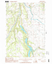
1988 Map of Cliff Lake
USGS Topo · Published 1989About this map
Beaverhead National Forest defines this high-elevation landscape, where the Madison River and its West Fork carve through the Madison County terrain. The survey captures a significant recreational and wilderness corridor in the late 1980s, highlighting the Lee Metcalf Wilderness on the eastern edge. A sequence of elongated water bodies, including Cliff Lake and Wade Lake, sit tucked between the Cliff Lake Bench and Wade Lake Bench. The arrangement of facilities like the Wade Lake Campground and Cliff Point Campground alongside the Boatramp indicates the area's established role for outdoor access. Away from the water, the topography rises toward the Horn Mountains, intersected by drainages such as Jackpine Gulch and Well Gulch, reflecting a landscape managed for both timber and preservation.
Find a feature on this map
29 named features on this map. Tap any name to fly to it.
Don’t see what you’re looking for? This feature index may not catch every label — zoom into the map to look around manually.
Map Details
Editions of this 1988 Cliff Lake Map
2 editions found
Other maps of this area

1950 · Cliff Lake
USGS Topo · 1:62,500

1950 · Hebgen Dam
USGS Topo · 1:62,500

1950 · Upper Red Rock Lake
USGS Topo · 1:62,500

1955 · Ashton
USGS Topo · 1:250,000

1958 · Ashton
USGS Topo · 1:250,000

1960 · Ashton
USGS Topo · 1:250,000

1964 · Targhee Peak
USGS Topo · 1:24,000

1964 · Henrys Lake
USGS Topo · 1:62,500
1988 · Granite Mountain
USGS Topo · 1:24,000
1988 · Hidden Lake Bench
USGS Topo · 1:24,000