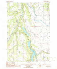
1988 Map of Cliff Lake
USGS Topo · Published 1989About this map
The Madison River and its West Fork Madison River dominate this landscape within the Beaverhead National Forest during the late 1980s. A striking chain of water bodies, including Wade Lake and Cliff Lake, is situated between prominent topographical features like Wade Lake Bench and Cliff Lake Bench. This area shows a focused recreation and conservation footprint, with designated sites such as Hilltop Campground and Cliff Point Campground tucked along the lake margins. To the east, the terrain transitions into the high-altitude Missouri Flats, while the northeastern corner reaches into the Lee Metcalf Wilderness. The presence of small Gravel Pits and the winding Jackpine Bench Road indicate the sparse but essential infrastructure supporting this remote mountain environment. This period shows the drainage patterns of Antelope Prong and Horn Creek before modern developments, preserved in their late-twentieth-century state.
Find a feature on this map
31 named features on this map. Tap any name to fly to it.
Don’t see what you’re looking for? This feature index may not catch every label — zoom into the map to look around manually.
Map Details
Editions of this 1988 Cliff Lake Map
2 editions found
Other maps of this area

1950 · Cliff Lake
USGS Topo · 1:62,500

1950 · Hebgen Dam
USGS Topo · 1:62,500

1950 · Upper Red Rock Lake
USGS Topo · 1:62,500

1955 · Ashton
USGS Topo · 1:250,000

1958 · Ashton
USGS Topo · 1:250,000

1960 · Ashton
USGS Topo · 1:250,000

1964 · Targhee Peak
USGS Topo · 1:24,000

1964 · Henrys Lake
USGS Topo · 1:62,500
1988 · Granite Mountain
USGS Topo · 1:24,000
1988 · Hidden Lake Bench
USGS Topo · 1:24,000