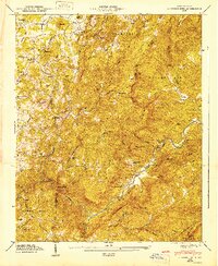
1947 Map of Cliffield Mtn
USGS Topo · Published 1947About this map
The Blue Ridge escarpment dominates this 1946 field study, where the border between Henderson and Polk counties follows the high mountain ridges. The landscape is defined by the steep descent toward the Green River, which carves through a dramatic gorge known as The Narrows. Small upland communities and family enclaves are scattered throughout the valleys, connected by winding routes like Sugarloaf Rd and Blue Ridge Rd.
Find a feature on this map
60 named features on this map. Tap any name to fly to it.
Don’t see what you’re looking for? This feature index may not catch every label — zoom into the map to look around manually.
Map Details
Editions of this 1947 Cliffield Mtn Map
2 editions found

Other maps of this area

1907 · Saluda
USGS Topo · 1:125,000

1935 · Batcave
USGS Topo · 1:24,000

1935 · Hendersonville
USGS Topo · 1:24,000

1935 · Fishtop
USGS Topo · 1:24,000

1935 · Zirconia
USGS Topo · 1:24,000

1936 · Fruitland
USGS Topo · 1:24,000

1942 · Fruitland
USGS Topo · 1:24,000

1946 · Zirconia
USGS Topo · 1:24,000

1946 · Bat Cave
USGS Topo · 1:24,000
1946 · Hendersonville
USGS Topo · 1:24,000