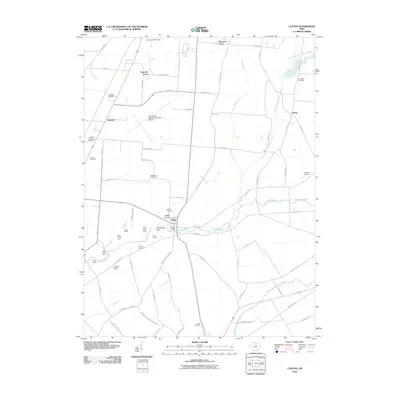
2010 Map of Clifton
USGS Topo · Published 2010About this map
Clifton Mill stands as a prominent landmark on the banks of the Little Miami River, marking a focal point of industry and geography in this part of Greene County. The area is defined by the dramatic topography of the Clifton Gorge and the notable formation of Steamboat Rock, which distinguish the river corridor from the surrounding agricultural uplands. Settlement patterns are visible in the clusters of Shawnee Acres, Peacock Acres, and the village of Clifton.
Find a feature on this map
75 named features on this map. Tap any name to fly to it.
Don’t see what you’re looking for? This feature index may not catch every label — zoom into the map to look around manually.
Map Details
Editions of this 2010 Clifton Map
This is the sole edition of this map. No revisions or reprints were ever made.
Other maps of this area

1904 · Springfield
USGS Topo · 1:62,500

1906 · Springfield
USGS Topo · 1:62,500

1907 · South Charleston
USGS Topo · 1:62,500

1916 · Octa
USGS Topo · 1:62,500

1917 · Xenia
USGS Topo · 1:62,500

1944 · Octa
USGS Topo · 1:62,500

1947 · Columbus
USGS Topo · 1:250,000

1954 · Clifton
USGS Topo · 1:24,000
1955 · Springfield
USGS Topo · 1:24,000
1955 · Donnelsville
USGS Topo · 1:24,000