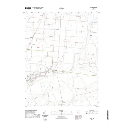
2019 Map of Clifton
USGS Topo · Published 2019About this map
Clifton Gorge and the dramatic geological formations of the Little Miami River dominate this portion of Greene County. The waterway carves through the landscape at The Narrows, passing landmarks like Steamboat Rock as it flows toward the village of Clifton. To the south, Cedarville sits near the confluence of Clark Run and North Fork Massies Creek, while the northern reaches transition into the agricultural plains of Clark County near Pitchin and Hustead.
Find a feature on this map
101 named features on this map. Tap any name to fly to it.
Don’t see what you’re looking for? This feature index may not catch every label — zoom into the map to look around manually.
Map Details
Editions of this 2019 Clifton Map
This is the sole edition of this map. No revisions or reprints were ever made.
Other maps of this area

1904 · Springfield
USGS Topo · 1:62,500

1906 · Springfield
USGS Topo · 1:62,500

1907 · South Charleston
USGS Topo · 1:62,500

1916 · Octa
USGS Topo · 1:62,500

1917 · Xenia
USGS Topo · 1:62,500

1944 · Octa
USGS Topo · 1:62,500

1947 · Columbus
USGS Topo · 1:250,000

1954 · Clifton
USGS Topo · 1:24,000
1955 · Springfield
USGS Topo · 1:24,000
1955 · Donnelsville
USGS Topo · 1:24,000