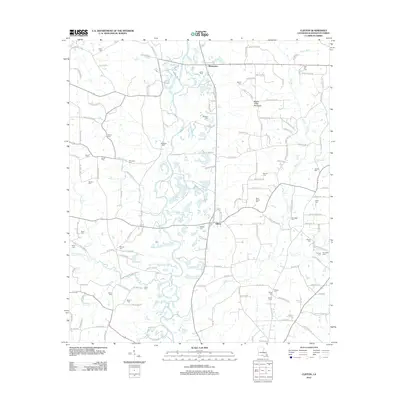
2012 Map of Clifton
USGS Topo · Published 2012About this map
Bogue Chitto and its numerous tributaries, including Hays Cr and Miller Cr, define the landscape of this Washington Parish map. The settlement patterns at Warnerton and Clifton are accompanied by an unusually high density of family and community burial grounds, providing a significant resource for genealogical research. Named cemeteries such as Star Hill Cem, Bickham Cem, and Magee Cem are scattered across the terrain, often located near local road junctions or watercourses. The presence of Bogue Chitto Mountain stands out as a prominent local landmark in an area otherwise characterized by the winding paths of Bayou Beth and Jamaeson Cr. The road network, featuring routes like Holmesville Rd and Tate Rd, connects these rural hubs and historic family sites.
Find a feature on this map
135 named features on this map. Tap any name to fly to it.
Don’t see what you’re looking for? This feature index may not catch every label — zoom into the map to look around manually.
Map Details
Editions of this 2012 Clifton Map
This is the sole edition of this map. No revisions or reprints were ever made.
Other maps of this area

1939 · Sunny Hill
USGS Topo · 1:31,680

1939 · Clifton
USGS Topo · 1:31,680

1942 · Thigpen
USGS Topo · 1:31,680

1942 · Wilmer
USGS Topo · 1:31,680

1942 · Thomas
USGS Topo · 1:31,680

1950 · Franklinton
USGS Topo · 1:31,680

1953 · Natchez
USGS Topo · 1:250,000

1954 · Baton Rouge
USGS Topo · 1:250,000

1956 · Natchez
USGS Topo · 1:250,000

1956 · Baton Rouge
USGS Topo · 1:250,000