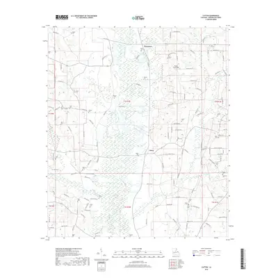
2018 Map of Clifton
USGS Topo · Published 2018About this map
The low-lying piney woods of Washington Parish are defined by the winding course of the Bogue Chitto river and its many tributaries, such as Hays Cr and Mud Cr. This 2018 survey reveals a landscape where modern parish roads follow long-established routes between small settlements like Warnerton and Clifton. The map is particularly valuable for genealogists, as it documents an exceptional density of family and community burial grounds, including the Star Hill Cem and the Brumfield Cem near Jamaeson Cr. The terrain rises slightly at Bogue Chitto Mtn, while the surrounding bottomlands are crisscrossed by a complex network of local lanes like Sam Smith Rd and Silas Schilling Rd, reflecting the deep-rooted rural character of this Louisiana-Mississippi border region.
Find a feature on this map
130 named features on this map. Tap any name to fly to it.
Don’t see what you’re looking for? This feature index may not catch every label — zoom into the map to look around manually.
Map Details
Editions of this 2018 Clifton Map
This is the sole edition of this map. No revisions or reprints were ever made.
Other maps of this area

1939 · Sunny Hill
USGS Topo · 1:31,680

1939 · Clifton
USGS Topo · 1:31,680

1942 · Thigpen
USGS Topo · 1:31,680

1942 · Wilmer
USGS Topo · 1:31,680

1942 · Thomas
USGS Topo · 1:31,680

1950 · Franklinton
USGS Topo · 1:31,680

1953 · Natchez
USGS Topo · 1:250,000

1954 · Baton Rouge
USGS Topo · 1:250,000

1956 · Natchez
USGS Topo · 1:250,000

1956 · Baton Rouge
USGS Topo · 1:250,000