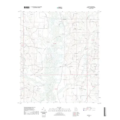
2020 Map of Clifton
USGS Topo · Published 2020About this map
Bogue Chitto flows through the heart of Washington Parish, Louisiana, anchoring a rural landscape defined by extensive wetland networks and family-named cemeteries. Near the settlement of Warnerton, the terrain rises toward the local landmark of Bogue Chitto Mtn, while further south, the community of Clifton sits near the confluence of major drainage systems. The survey reveals a high density of burial sites that trace the region's genealogical history, including the Warner Cem, Magee Cem, and Bickham Cem. This web of parish roads, such as Parish Rd 158 and Parish Rd 27, connects these small communities and isolated homesteads across the bottomlands of Silver Creek and Hays Creek. The map provides a contemporary view of this piney woods region, showing the enduring spatial relationship between family legacies and the river environment.
Find a feature on this map
124 named features on this map. Tap any name to fly to it.
Don’t see what you’re looking for? This feature index may not catch every label — zoom into the map to look around manually.
Map Details
Editions of this 2020 Clifton Map
This is the sole edition of this map. No revisions or reprints were ever made.
Other maps of this area

1939 · Sunny Hill
USGS Topo · 1:31,680

1939 · Clifton
USGS Topo · 1:31,680

1942 · Thigpen
USGS Topo · 1:31,680

1942 · Wilmer
USGS Topo · 1:31,680

1942 · Thomas
USGS Topo · 1:31,680

1950 · Franklinton
USGS Topo · 1:31,680

1953 · Natchez
USGS Topo · 1:250,000

1954 · Baton Rouge
USGS Topo · 1:250,000

1956 · Natchez
USGS Topo · 1:250,000

1956 · Baton Rouge
USGS Topo · 1:250,000