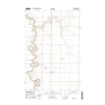
2016 Map of Climax
USGS Topo · Published 2016About this map
The Red River of the North winds in tight, serpentine oxbows along the border of Minnesota and North Dakota, defining the western edge of this Polk County landscape. This 2016 survey illustrates the agricultural character of the Red River Valley, where the grid of county roads meets the natural meanders of the river. The small settlement of Climax sits at the junction of Co Rd 220 and Highway 75, while Nielsville anchors the southern portion of the map near the Nielsville Airport. Family history is preserved through localized landmarks such as Skatvold Cem, Bergit Cem, and Sundet Cem. The hydrological complexity of the region is evident in the confluence of the Sand Hill River and the extensive drainage systems like County Ditch Number One Hundred Sixtysix that support the surrounding farmland.
Find a feature on this map
33 named features on this map. Tap any name to fly to it.
Don’t see what you’re looking for? This feature index may not catch every label — zoom into the map to look around manually.
Map Details
Editions of this 2016 Climax Map
This is the sole edition of this map. No revisions or reprints were ever made.
Other maps of this area

1918 · Hendrum
USGS Topo · 1:62,500

1919 · Eldred
USGS Topo · 1:62,500

1919 · Beltrami
USGS Topo · 1:62,500

1924 · Ada
USGS Topo · 1:62,500

1952 · Grand Forks
USGS Topo · 1:250,000

1956 · Grand Forks
USGS Topo · 1:250,000

1963 · Shelly
USGS Topo · 1:24,000

1964 · Beltrami SW
USGS Topo · 1:24,000

1964 · Girard
USGS Topo · 1:24,000

1964 · Climax NW
USGS Topo · 1:24,000