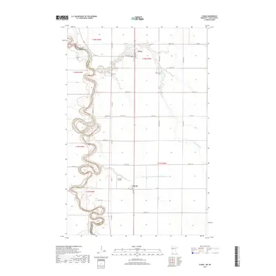
2019 Map of Climax
USGS Topo · Published 2019About this map
The Red River of the North carves a serpentine boundary between North Dakota and Minnesota on this detailed 2019 survey. The landscape is defined by the stark geometry of Section-Line roads and the winding path of the Sand Hill River, which flows westward to join the Red River. Centered on the small agricultural communities of Climax and Nielsville, the map captures a rural environment where land use is dominated by large-scale drainage projects like County Ditch Number One Hundred Sixtysix. For those researching local family histories, the map identifies several rural burial grounds, including Bergit Cem, Skatvold Cem, and Sundet Cem, which remain as long-standing landmarks in the flat valley terrain. Transportation is anchored by the crossing of Co Hwy 1 and the small-craft facilities at Nielsville Airport.
Find a feature on this map
35 named features on this map. Tap any name to fly to it.
Don’t see what you’re looking for? This feature index may not catch every label — zoom into the map to look around manually.
Map Details
Editions of this 2019 Climax Map
This is the sole edition of this map. No revisions or reprints were ever made.
Other maps of this area

1918 · Hendrum
USGS Topo · 1:62,500

1919 · Eldred
USGS Topo · 1:62,500

1919 · Beltrami
USGS Topo · 1:62,500

1924 · Ada
USGS Topo · 1:62,500

1952 · Grand Forks
USGS Topo · 1:250,000

1956 · Grand Forks
USGS Topo · 1:250,000

1963 · Shelly
USGS Topo · 1:24,000

1964 · Beltrami SW
USGS Topo · 1:24,000

1964 · Girard
USGS Topo · 1:24,000

1964 · Climax NW
USGS Topo · 1:24,000