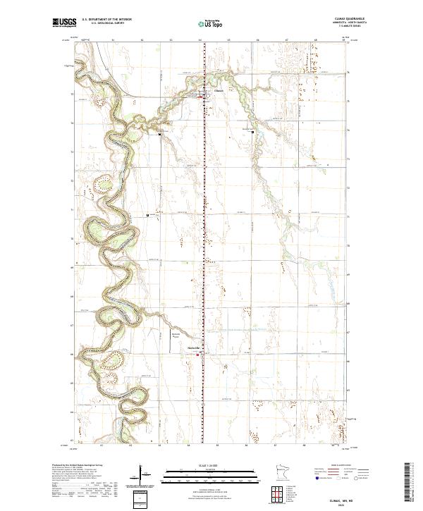
2022 Map of Climax
USGS Topo · Published 2022About this map
The Red River of the North winds in tight, serpentine oxbows along the border of Minnesota and North Dakota, carving a complex boundary through the flat agricultural plains of Polk and Traill Counties. This 2022 survey documents the persistent rural character of the region, anchored by the small settlements of Climax and Nielsville. The landscape is dominated by a strict section-line road grid, occasionally interrupted by the wandering path of the Sand Hill River and artificial drainage systems like County Ditch Number One Hundred Sixtysix. For those researching local family history, several small burial grounds are preserved across the township, including Bergit Cem, Skatvold Cem, and Sundet Cem. The presence of the Nielsville Airport south of its namesake town highlights the importance of aerial access in this deeply rural corridor.
Find a feature on this map
30 named features on this map. Tap any name to fly to it.
Don’t see what you’re looking for? This feature index may not catch every label — zoom into the map to look around manually.
Map Details
Editions of this 2022 Climax Map
This is the sole edition of this map. No revisions or reprints were ever made.
Other maps of this area

1918 · Hendrum
USGS Topo · 1:62,500

1919 · Eldred
USGS Topo · 1:62,500

1919 · Beltrami
USGS Topo · 1:62,500

1924 · Ada
USGS Topo · 1:62,500

1952 · Grand Forks
USGS Topo · 1:250,000

1956 · Grand Forks
USGS Topo · 1:250,000

1963 · Shelly
USGS Topo · 1:24,000

1964 · Beltrami SW
USGS Topo · 1:24,000

1964 · Girard
USGS Topo · 1:24,000

1964 · Climax NW
USGS Topo · 1:24,000