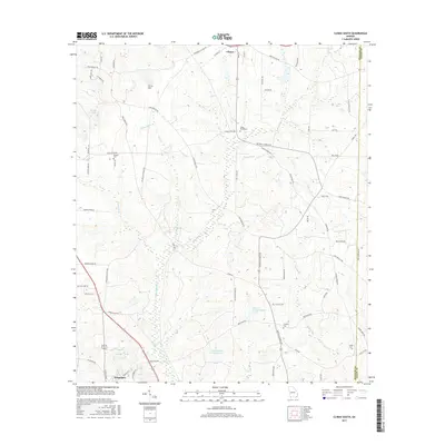
2017 Map of Climax South
USGS Topo · Published 2017About this map
Attapulgus and Climax anchor the north and south ends of this Decatur County landscape, situated just west of the Grady County border. The area is defined by a dense network of watercourses and family-named landmarks, including the high ground of Curry Hill and the drainage of Attapulgus Cr. The map reveals a deeply rooted rural community, indicated by the distribution of several small burial grounds such as Cedar Grove Cem, Samuel Cem, Conyers Cem, and Butler Cem. Industry and land use are reflected in specialized water features like Dubarco Incorporated Lake and Coastal Loan Company Lake. Local transit is characterized by a grid of named roads like Attapulgus Climax Rd and Lake Douglas Rd, which connect these small South Georgia settlements through the timber and agricultural lands of the Florida borderlands.
Find a feature on this map
67 named features on this map. Tap any name to fly to it.
Don’t see what you’re looking for? This feature index may not catch every label — zoom into the map to look around manually.
Map Details
Editions of this 2017 Climax South Map
This is the sole edition of this map. No revisions or reprints were ever made.
Other maps of this area

1954 · Tallahassee
USGS Topo · 1:250,000

1955 · Bainbridge
USGS Topo · 1:62,500

1955 · Whigham
USGS Topo · 1:62,500

1956 · Havana North
USGS Topo · 1:24,000

1956 · Dogtown
USGS Topo · 1:24,000

1956 · Calvary
USGS Topo · 1:24,000

1959 · Tallahassee
USGS Topo · 1:250,000

1960 · Tallahassee
USGS Topo · 1:250,000
1974 · Bainbridge
USGS Topo · 1:24,000
1974 · Fowlstown
USGS Topo · 1:24,000