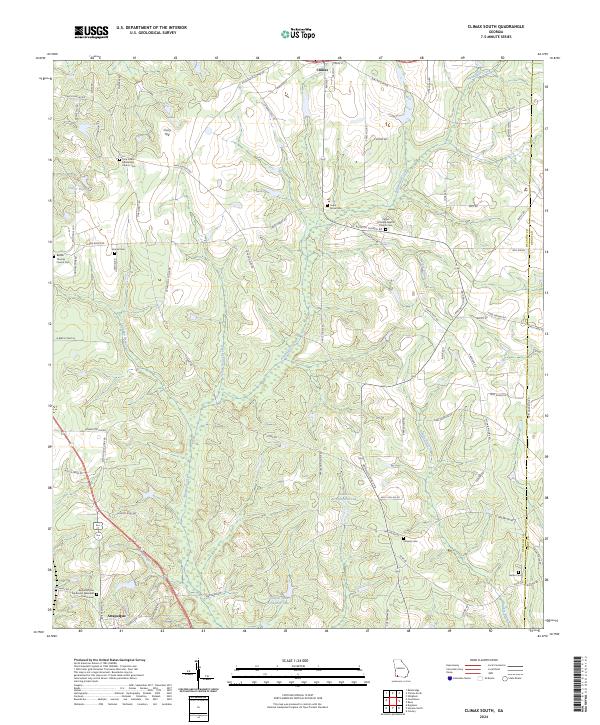
2024 Map of Climax South
USGS Topo · Published 2024About this map
Attapulgus and Climax anchor this southern Georgia landscape, connected by a network of rural routes such as Attapulgus Climax Rd and Lake Douglas Rd. The area is notably dense with community heritage sites, including numerous family and church burial grounds like Samuel Cem, Conyers Cem, and Butler Cem. These sites, often situated near congregations like the Pisgah Primitive Baptist Church Cem and the Bethel African Methodist Episcopal Church, reflect the deep-rooted social and genealogical history of Decatur County.
Find a feature on this map
80 named features on this map. Tap any name to fly to it.
Don’t see what you’re looking for? This feature index may not catch every label — zoom into the map to look around manually.
Map Details
Editions of this 2024 Climax South Map
This is the sole edition of this map. No revisions or reprints were ever made.
Other maps of this area

1954 · Tallahassee
USGS Topo · 1:250,000

1955 · Bainbridge
USGS Topo · 1:62,500

1955 · Whigham
USGS Topo · 1:62,500

1956 · Havana North
USGS Topo · 1:24,000

1956 · Dogtown
USGS Topo · 1:24,000

1956 · Calvary
USGS Topo · 1:24,000

1959 · Tallahassee
USGS Topo · 1:250,000

1960 · Tallahassee
USGS Topo · 1:250,000
1974 · Bainbridge
USGS Topo · 1:24,000
1974 · Fowlstown
USGS Topo · 1:24,000