
1964 Map of Climax SW
USGS Topo · Published 1966About this map
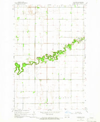
Buffalo Coulee meanders through the central Red River Valley, defining the rural character of these township lands in the mid-1960s. The landscape is primarily organized by the townships of Stavanger, Belmont, Ervin, and Bingham, where small community hubs like Townhall and School No 5 once anchored local life. For genealogists, the map preserves the exact locations of several pioneer-era focal points, including Grue Ch and its neighboring Hillstead Cem, as well as Salem Ch and Salem Cem further south. These sites, often situated near the section lines of the survey grid, represent the religious and social foundations of the Norwegian-American agricultural communities that settled this part of Traill County. The northeastern corner touches the Red River, featuring Belmont Park and the Ringsaker Ch Cem along the winding riverbanks.
Find a feature on this map
19 named features on this map. Tap any name to fly to it.
Don’t see what you’re looking for? This feature index may not catch every label — zoom into the map to look around manually.
Map Details
Editions of this 1964 Climax SW Map
This is the sole edition of this map. No revisions or reprints were ever made.
Other maps of this area

1918 · Kelso
USGS Topo · 1:62,500

1918 · Hendrum
USGS Topo · 1:62,500

1919 · Eldred
USGS Topo · 1:62,500

1943 · Kelso
USGS Topo · 1:62,500

1952 · Grand Forks
USGS Topo · 1:250,000

1956 · Grand Forks
USGS Topo · 1:250,000

1963 · Shelly
USGS Topo · 1:24,000

1963 · Hillsboro
USGS Topo · 1:24,000

1964 · Climax NW
USGS Topo · 1:24,000
1964 · Caledonia
USGS Topo · 1:24,000