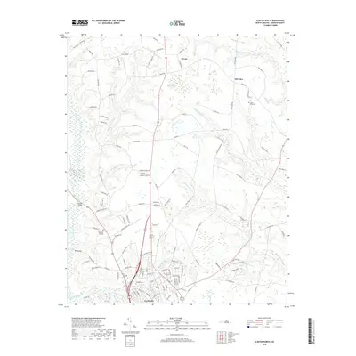
2019 Map of Clinton North
USGS Topo · Published 2019About this map
Clinton serves as the southern anchor of this coastal plain landscape, where urban development meets a dense network of blackwater streams and swampy lowlands. The drainage pattern is dominated by Beaverdam Swamp and the Great Coharie Cr, with smaller tributaries like Meetinghouse Br and Royal Mill Br carving through the agricultural terrain. These watercourses historically dictated the placement of early infrastructure, seen in crossings like Stevens Bridge and New Bridge. North of the city, smaller communities such as Keener and McCullen are established along rural corridors like Keener Rd. For genealogists, the map identifies several significant burial sites, including Sandhills Cem, the James King Cem, and the more expansive Grandview Memorial Gardens. The landscape is a mix of traditional homesteads and modern utility, evidenced by the Clinton Substation Rd near the city limits.
Find a feature on this map
122 named features on this map. Tap any name to fly to it.
Don’t see what you’re looking for? This feature index may not catch every label — zoom into the map to look around manually.
Map Details
Editions of this 2019 Clinton North Map
This is the sole edition of this map. No revisions or reprints were ever made.
Other maps of this area

1909 · Coharie
USGS Topo · 1:62,500

1953 · Florence
USGS Topo · 1:250,000

1953 · Raleigh
USGS Topo · 1:250,000

1954 · Florence
USGS Topo · 1:250,000

1954 · Raleigh
USGS Topo · 1:250,000

1959 · Garland
USGS Topo · 1:62,500

1962 · Rose Hill
USGS Topo · 1:62,500

1975 · Faison
USGS Topo · 1:24,000
1978 · Dobbersville
USGS Topo · 1:24,000

1982 · Elizabethtown
USGS Topo · 1:100,000