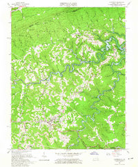
1963 Map of Clintwood
USGS Topo · Published 1965About this map
The town of Clintwood serves as a focal point for this 1960s study of Dickenson County, Virginia, where the extractive economy and rugged geography of the Appalachians are clearly visible. Dense networks of Strip Mines and local coal operations surround settlements like Georges Fork and Freeling, while the northern portion of the map is defined by the steep slopes of Pine Mountain and the Jefferson National Forest. This era marks a significant change in the local landscape with the appearance of the John W Flannagan Reservoir, which begins to fill the deep valley of the Pound River.
Find a feature on this map
121 named features on this map. Tap any name to fly to it.
Don’t see what you’re looking for? This feature index may not catch every label — zoom into the map to look around manually.
Map Details
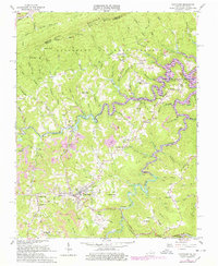
Editions of this 1963 Clintwood Map
2 editions found
Other maps of this area

1886 · Grundy
USGS Topo · 1:125,000

1890 · Whitesburg
USGS Topo · 1:125,000

1890 · Grundy
USGS Topo · 1:125,000

1892 · Grundy
USGS Topo · 1:125,000

1892 · Whitesburg
USGS Topo · 1:125,000

1912 · Pound
USGS Topo · 1:48,000

1913 · Clintwood
USGS Topo · 1:62,500

1914 · Pound
USGS Topo · 1:62,500

1914 · Vergie
USGS Topo · 1:48,000
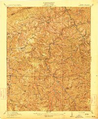
1915 · Clintwood
USGS Topo · 1:62,500