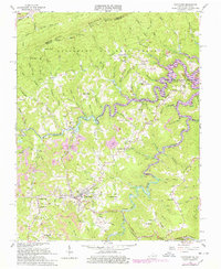
1963 Map of Clintwood
USGS Topo · Published 1978About this map
The county seat of Clintwood anchors this topographic study of Dickenson County, Virginia, during a period of transition for both the landscape and local industry. The recently completed John W Flannagan Reservoir dominates the eastern quadrant, its impounded waters flooding the deep valleys of the Pound River and its various tributaries like Fishtrap Branch. This massive hydrological shift is contrasted by the intensive industrial activity across the ridges, where numerous Strip Mines and conveyor systems reveal the scale of local coal operations.
Find a feature on this map
118 named features on this map. Tap any name to fly to it.
Don’t see what you’re looking for? This feature index may not catch every label — zoom into the map to look around manually.
Map Details
Editions of this 1963 Clintwood Map
2 editions found
Other maps of this area

1886 · Grundy
USGS Topo · 1:125,000

1890 · Whitesburg
USGS Topo · 1:125,000

1890 · Grundy
USGS Topo · 1:125,000

1892 · Grundy
USGS Topo · 1:125,000

1892 · Whitesburg
USGS Topo · 1:125,000

1912 · Pound
USGS Topo · 1:48,000

1913 · Clintwood
USGS Topo · 1:62,500

1914 · Pound
USGS Topo · 1:62,500

1914 · Vergie
USGS Topo · 1:48,000

1915 · Clintwood
USGS Topo · 1:62,500