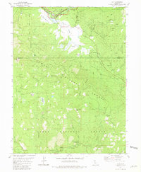
1981 Map of Clio
USGS Topo · Published 1981About this map
The Mohawk Valley and its surrounding Sierra Nevada heights are documented here in the early 1980s, centered on the settlement of Clio. This area is a significant meeting point of geography and industry, where the Western Pacific RR follows the Middle Fork Feather River through a landscape heavily defined by early mining operations and timber lands. The transition from the Plumas National Forest to the Tahoe National Forest is marked by high-altitude features like Haskell Peak and Chapman Saddle.
Find a feature on this map
53 named features on this map. Tap any name to fly to it.
Don’t see what you’re looking for? This feature index may not catch every label — zoom into the map to look around manually.
Map Details
Editions of this 1981 Clio Map
4 editions found
Other maps of this area

1890 · Sierraville
USGS Topo · 1:125,000

1891 · Downieville
USGS Topo · 1:125,000

1892 · Sierraville
USGS Topo · 1:125,000

1893 · Downieville
USGS Topo · 1:125,000

1894 · Sierraville
USGS Topo · 1:125,000

1895 · Downieville
USGS Topo · 1:125,000

1896 · Downieville
USGS Topo · 1:125,000

1897 · Downieville
USGS Topo · 1:125,000

1937 · Blairsden
USGS Topo · 1:48,000

1943 · Blairsden
USGS Topo · 1:62,500