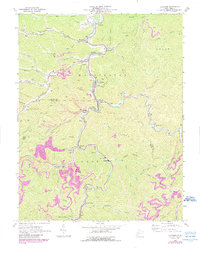
1963 Map of Clothier
USGS Topo · Published 1989About this map
The Guyan River and Spruce Fork define the industrial and residential geography of this West Virginia coal region. Extensive Strip Mines and deep mines dominate the hills surrounding Clothier, Sharples, and Monclo, revealing a landscape heavily modified by mid-20th-century extraction. Family heritage is deeply etched into the terrain through numerous small burial grounds such as Pauley Cem, Workman Cem, and Adkins Cem, which sit adjacent to mining operations and narrow creek branches.
Find a feature on this map
81 named features on this map. Tap any name to fly to it.
Don’t see what you’re looking for? This feature index may not catch every label — zoom into the map to look around manually.
Map Details
Editions of this 1963 Clothier Map
3 editions found
Other maps of this area

1891 · Oceana
USGS Topo · 1:125,000

1893 · Oceana
USGS Topo · 1:125,000

1898 · Oceana
USGS Topo · 1:125,000

1899 · Charleston
USGS Topo · 1:125,000

1909 · Peytona
USGS Topo · 1:48,000

1910 · Bald Knob
USGS Topo · 1:48,000

1911 · Peytona
USGS Topo · 1:62,500

1911 · Madison
USGS Topo · 1:62,500

1912 · Bald Knob
USGS Topo · 1:62,500

1913 · Logan
USGS Topo · 1:62,500